Google Maps Mania featured my little side project Companies Near Me today.
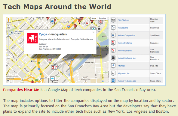
Google Maps Mania featured my little side project Companies Near Me today.
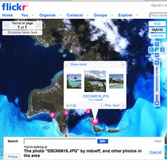
One of the only knocks against Flickr’s new geotagging service has been the lack of detailed maps for non-U.S. locations. It’s good to see that they’re making progress on expanding the maps. When I saw that they recently added maps for Bora Bora I decided to upload my honeymoon photos from 5 years ago. Check them out on a map here.
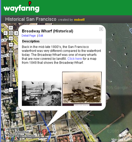
I’ve made some recent updates to the Historical San Francisco map on Wayfaring: